


The Qhapaq Ñan is the Andean road system that connected the Tahuantinsuyo. It is not a single trail or the trek that now leads to Machu Picchu: it is a network of main roads and branches that linked territories now belonging to six South American countries.
The Inca Trail to Machu Picchu is only one section of that network. This guide focuses on the Qhapaq Ñan: what its name means, what this network was, and which countries it connected.
What Is the Qhapaq Ñan?
Qhapaq Ñan, in Quechua, translates as main road or road of the Lord. It referred to the Inca state road: the backbone used to organize the territory, not a freely accessible path or leisure route.
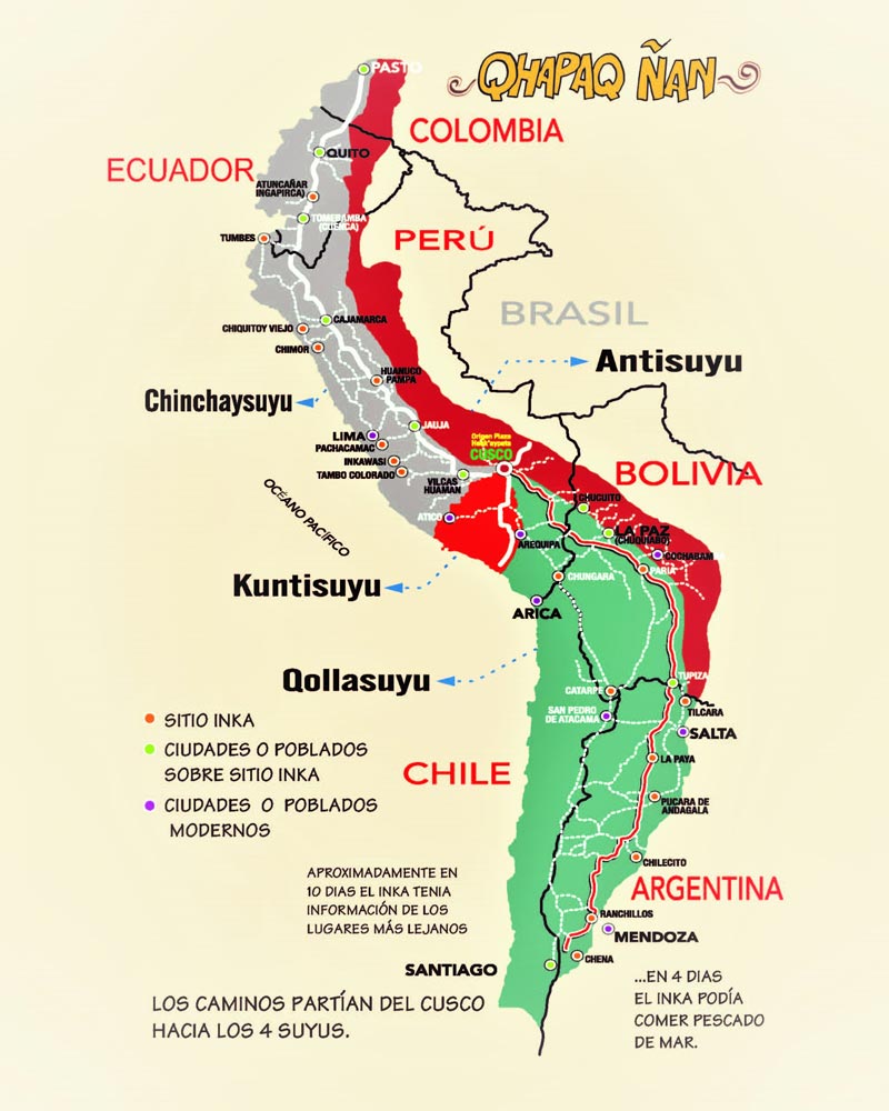
Nor was it a single line. It was a network of longitudinal routes and cross roads linking administrative, religious, and production centers. From Cusco, roads extended to the empire’s four regions, the Tahuantinsuyo.
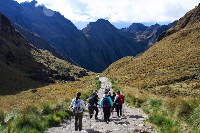
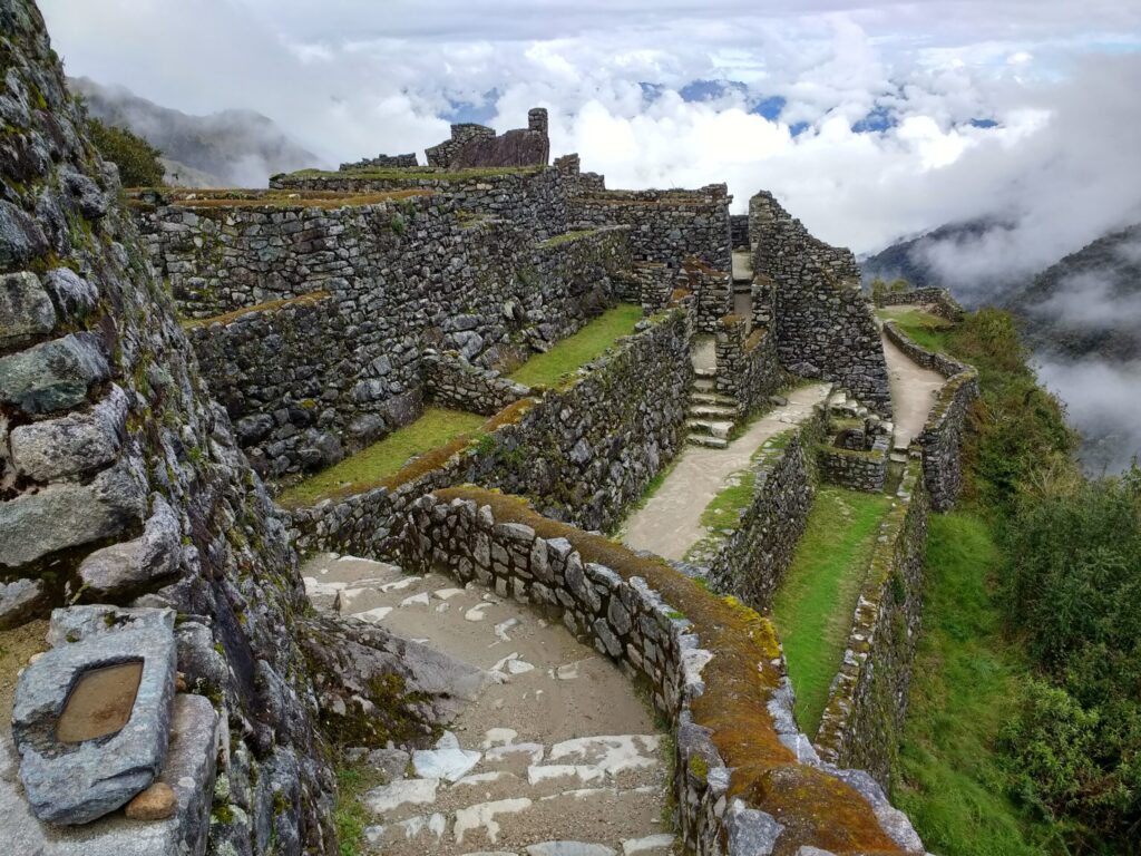
This network stretched for more than 30,000 kilometers. It crossed coastal deserts, inter-Andean valleys, highland puna grasslands, and high-altitude peaks. The route adapted to the terrain with stairways, retaining walls, drainage systems, and paved sections.
Which Countries Did the Qhapaq Ñan Connect?
The system did not stop at today’s borders. It linked territories that now belong to Colombia, Ecuador, Peru, Bolivia, Chile, and Argentina.
The Network’s Six Countries
- Colombia: the northernmost end of the network, in the south of the country.
- Ecuador: sections that linked the highlands with the rest of the Tahuantinsuyo.
- Peru: the heart of the system; Cusco was the hub from which the main routes departed.
- Bolivia: a connection between the Altiplano, the valleys, and the rest of the network.
- Chile: the southern route toward the desert and the valleys of the north and center.
- Argentina: the Andean northwest, where the network descends toward the provinces of present-day northern Argentina.
In 2014, UNESCO inscribed the Qhapaq Ñan – Andean Road System as a World Heritage Site. The designation is serial: it protects neither a single country nor the tourist section to Machu Picchu, but rather segments of this network across all six states.
How the Network Was Organized
Cusco served as the center. From there, roads led to Chinchaysuyo (north), Collasuyo (south), Antisuyo (east), and Contisuyo (west). These main routes were joined by branches descending to the coast or climbing into the puna.
The state did not start from scratch. It incorporated routes from earlier cultures and unified them under a shared design and administrative system. That is why the Qhapaq Ñan is best understood as a system rather than “the Inca road” in the singular.
What the Qhapaq Ñan Is Not
It is not the 4-day package to Machu Picchu. That route is a short branch of the network, now regulated as a trekking trail. The distance, itinerary, and permits for that section are covered in the guide to the Inca Trail to Machu Picchu.
Nor is it only “Peruvian history.” Without the sections in Colombia, Ecuador, Bolivia, Chile, and Argentina, the true scale of the system is lost.

Frequently Asked Questions
What does Qhapaq Ñan mean?
It is Quechua. It translates as main road or road of the Lord and refers to the road system of the Tahuantinsuyo.
Which countries did it connect?
The present-day territories of Colombia, Ecuador, Peru, Bolivia, Chile, and Argentina.
Is it the same as the Inca Trail to Machu Picchu?
No. The Qhapaq Ñan is the entire network. The Inca Trail to Machu Picchu is one section of that network.
How long was the network?
More than 30,000 kilometers, according to the most widely cited estimates of the Inca road system.